🌿 GROWPlantWell – Nurture Nature, Transform Your Space 🌿
Top GIS Applications in Agriculture: Boosting Crop Yields, Soil Health & Farm Efficiency
Explore how GIS technology transforms agriculture with precision farming, real-time data mapping, and satellite imagery—enhancing crop yields, soil analysis, and farm management
Khurram Shehzad
8/7/20254 min read
Introduction: What is GIS in Agriculture?
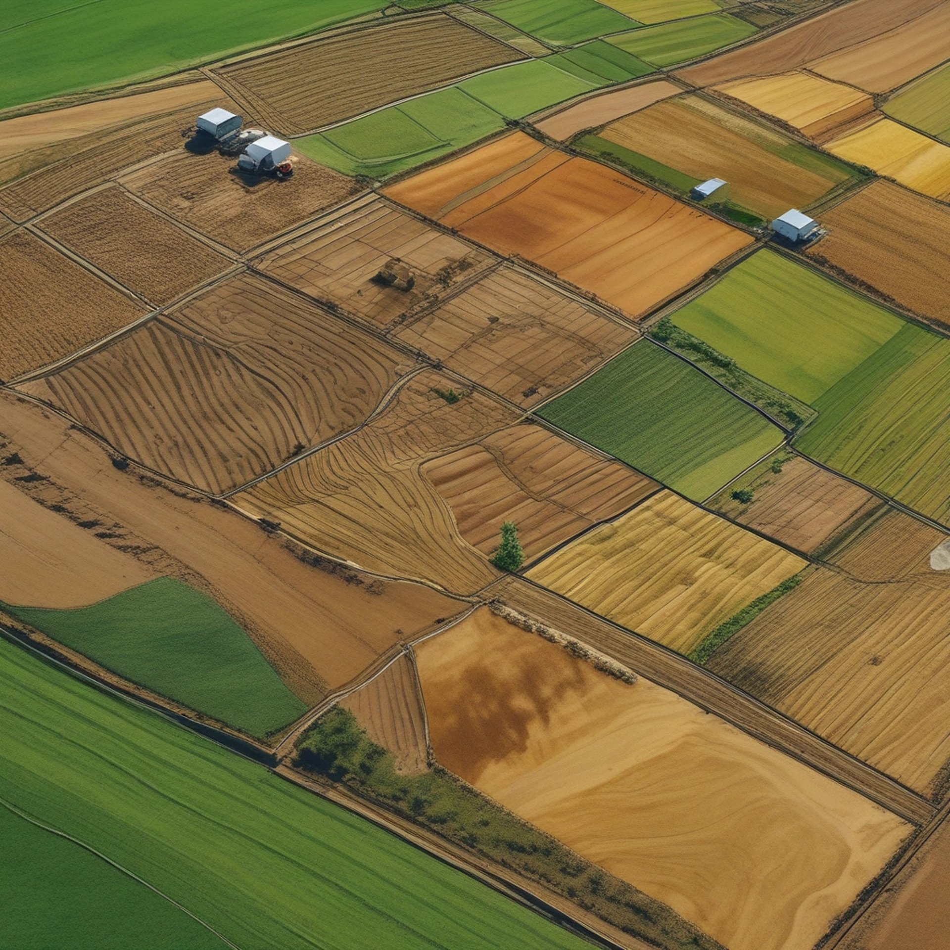
Geographic Information Systems (GIS) is a powerful technology that uses spatial data and mapping tools to analyze and visualize geographic information. In agriculture, GIS plays a vital role in transforming traditional farming into a high-efficiency, data-driven practice. From mapping soil types to managing crop health, GIS allows farmers to make smarter, more sustainable decisions.
Key Applications of GIS in Agriculture
🚜 How GIS is Revolutionising Farming Practices
GIS is not just a tool—it’s a game-changer for farmers, researchers, and agribusinesses. Here’s how:
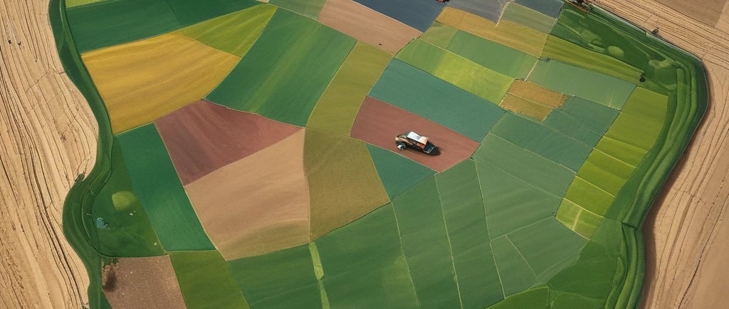
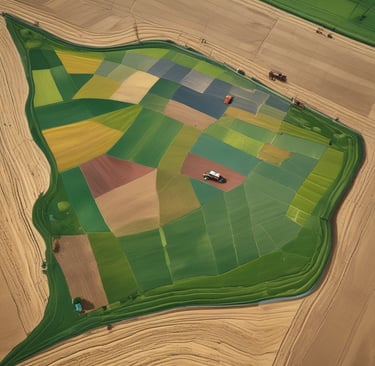
1. Precision Agriculture
GIS allows farmers to treat different areas of their fields according to their specific needs—this is called site-specific management.
Maps soil types, fertility, and moisture content
Enables targeted use of water, fertiliser, and pesticides
Increases crop yields while reducing waste
2. Crop Health Monitoring
GIS combined with satellite imagery and drones helps detect:
Nutrient deficiencies
Pest and disease outbreaks
Plant stress from drought or waterlogging
Farmers can react quickly, preventing widespread damage and improving productivity.
3. Soil & Land Use Mapping
Understanding the land is key. GIS tools help:
Classify soil types and their suitability for different crops
Plan crop rotation and field layout
Prevent erosion and degradation through smart land use
4. Irrigation Planning
GIS helps design efficient irrigation systems by analysing:
Topography (slope, elevation)
Soil water-holding capacity
Weather and rainfall data
This reduces water waste and improves irrigation scheduling.
5. Yield Mapping & Forecasting
By integrating GIS with yield monitors, farmers can:
Visualise which parts of a field are most productive
Compare seasonal performance
Forecast future yields and make financial plans
6. Disaster Management & Risk Reduction
GIS is essential for climate-smart agriculture:
Identifies areas at risk of flooding, drought, or fire
Supports early warning systems
Helps in post-disaster recovery and replanting efforts
7. Farm Planning & Policy Support
Governments and organisations use GIS to:
Plan land use and zoning
Monitor agricultural trends and land degradation
Make data-informed policy decisions
Benefits of GIS in Farming
✅ Improved decision-making
✅ Cost reduction by applying inputs only where needed
✅ Enhanced productivity and sustainability
✅ Early detection of problems
✅ Long-term farm monitoring and planning
Future of GIS in Agriculture
The future is bright for GIS-driven agriculture. Combined with IoT, AI, and drones, GIS will continue to empower farmers to feed the world more efficiently and sustainably. As precision agriculture becomes more common, GIS will be at the heart of every smart farm.
GIS isn't just a tech trend—it's a necessity. It connects land, people, and data to create resilient, productive, and sustainable farming systems for the future.
GIS in Agriculture: Frequently Asked Questions (FAQs) with Answers
1. What is GIS and how does it work in agriculture?
GIS (Geographic Information System) is a tool that captures, stores, and analyzes spatial and geographic data. In agriculture, it is used to map and assess variables like soil type, crop health, water availability, and weather patterns to guide better decision-making.
2. How does GIS help farmers make better decisions?
GIS helps farmers visualize field conditions and patterns by integrating layers of data. This allows them to optimize planting, irrigation, fertilization, and pest control, ultimately improving yields and reducing costs.
3. What’s the difference between GPS and GIS in farming?
GPS (Global Positioning System) provides real-time location tracking, whereas GIS analyzes and interprets data related to those locations. GPS tells you "where," GIS tells you "what and why."
4. How has GIS changed traditional farming methods?
GIS has revolutionized farming by moving it from intuition-based to data-driven decision-making. It allows for precision agriculture, which increases efficiency and sustainability.
5. How can GIS be used to monitor crop health?
GIS integrates data from drones, satellites, and field sensors to track vegetation indices (like NDVI), which indicate crop vigor, stress, and disease. This helps in early intervention.
6. Can GIS help in predicting crop yield?
Yes. GIS uses historical yield data, weather forecasts, and current crop conditions to model and predict future yields, aiding in planning and marketing.
7. How is GIS applied in irrigation and water management?
GIS maps soil moisture levels, topography, and water flow to design efficient irrigation systems and prevent over- or under-watering.
8. How does GIS support soil mapping and analysis?
GIS helps create detailed soil maps that reveal pH levels, nutrient content, and texture. This enables site-specific fertilizer and amendment recommendations.
9. In what ways can GIS assist in pest and disease management?
By mapping outbreaks and tracking conditions favorable to pests or diseases, GIS helps target interventions, reducing the spread and minimizing pesticide use.
10. What other technologies work well with GIS in agriculture?
Technologies like drones, remote sensing, IoT devices, AI, and machine learning work synergistically with GIS for real-time data collection and advanced analysis.
11. How are remote sensing and satellite imagery used in GIS mapping?
They provide real-time data on vegetation, soil, and weather conditions across large areas. GIS processes this data into actionable insights for farm management.
12. Can small farms benefit from GIS, or is it just for large-scale operations?
Small farms can absolutely benefit, especially with mobile-based GIS tools and affordable data services. It helps them be more efficient and competitive.
13. How do mobile apps use GIS to support farmers?
Mobile apps use GIS to provide real-time field data, location-specific advice, and record-keeping tools. This helps with on-the-go decision-making.
14. How does GIS contribute to sustainable farming practices?
GIS helps monitor and reduce resource use, prevent soil degradation, and manage land more effectively, promoting long-term sustainability.
15. What role does GIS play in climate-smart agriculture?
GIS supports adaptation strategies by mapping climate risks, assessing vulnerability, and identifying suitable crops or practices for future conditions.
16. Can GIS reduce farming costs and increase profitability?
Yes. By optimizing inputs and reducing waste, GIS improves efficiency and profitability while maintaining or enhancing yields.
17. What are the most popular GIS software tools used in agriculture?
Popular tools include ArcGIS, QGIS, Trimble Ag Software, Ag Leader SMS, and Cropio. Many are tailored for precision agriculture needs.
18. Are there open-source GIS tools available for farmers?
Yes. QGIS and GRASS GIS are open-source tools widely used for agricultural mapping and analysis without high licensing costs.
19. What is the future of GIS in precision agriculture?
The future includes AI-driven predictive analytics, real-time automation, and greater integration with robotics and satellite constellations.
20. How can GIS support global food security efforts?
GIS helps monitor crop production, assess land suitability, plan resource allocation, and respond to climate impacts, contributing to informed policymaking and food distribution strategies.